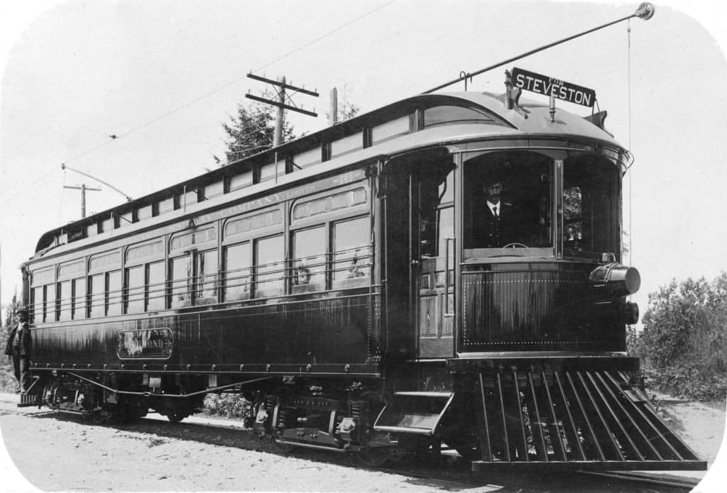
“The Sockeye Special” – Connecting Vancouver to Steveston’s Fishing Industry
The Arbutus Corridor was carved out by the CPR at the turn of the 20th century to connect Vancouver to the northern arm of the Fraser River and beyond to Steveston’s thriving fishing and canning industry. At the time, Steveston was one of the larger communities in the region – home to 29 canneries and a population of up to 10,000 during fishing season. The Lulu Island Railway (a CPR subsidiary) – soon dubbed the “Sockeye Limited” or Sockeye Special – began service in June 1902 with two trains per day.
The BCER Interurban Line
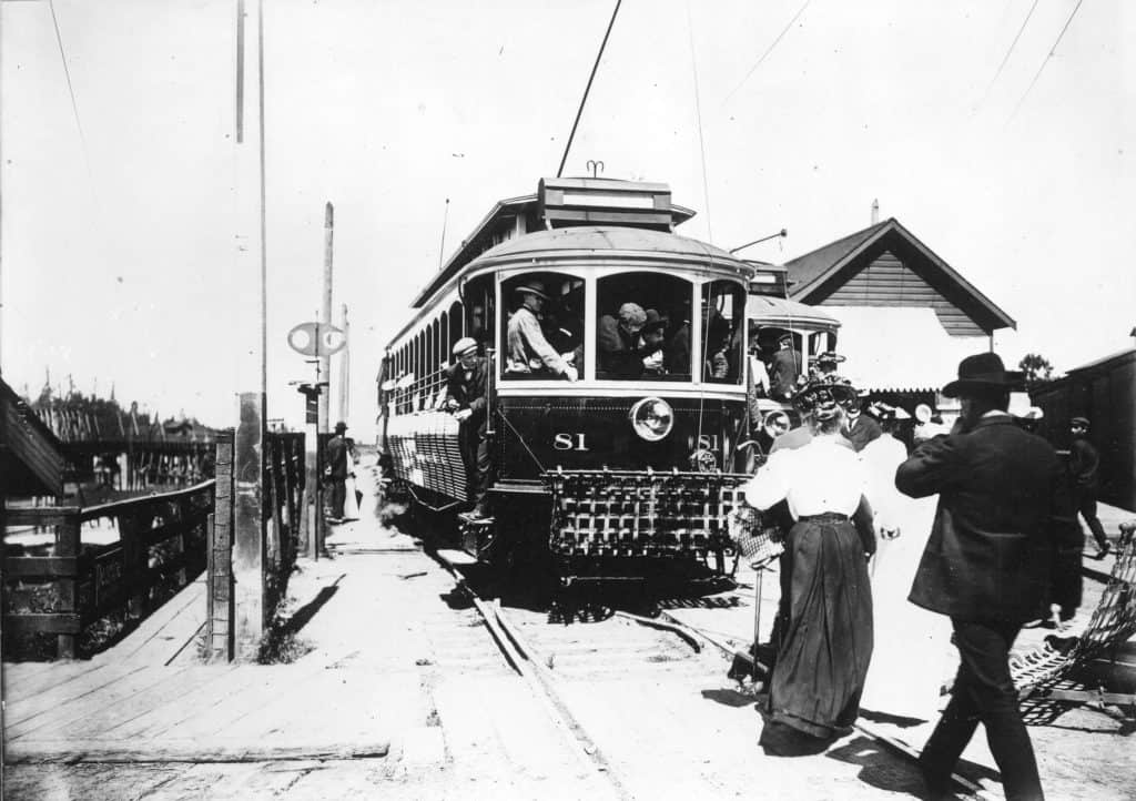
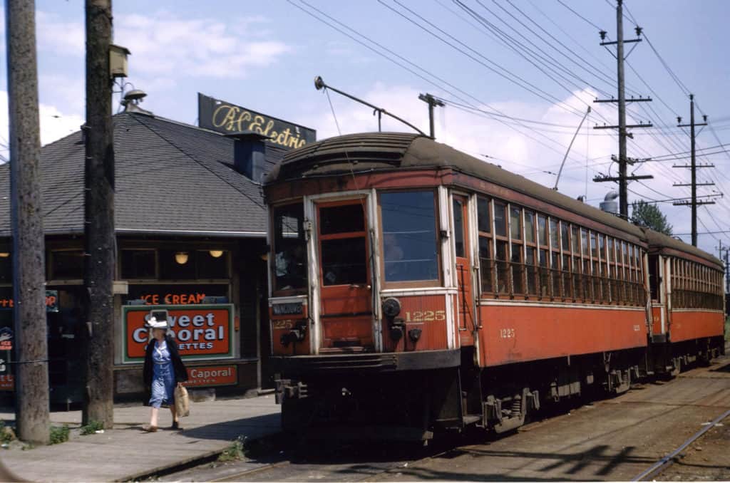
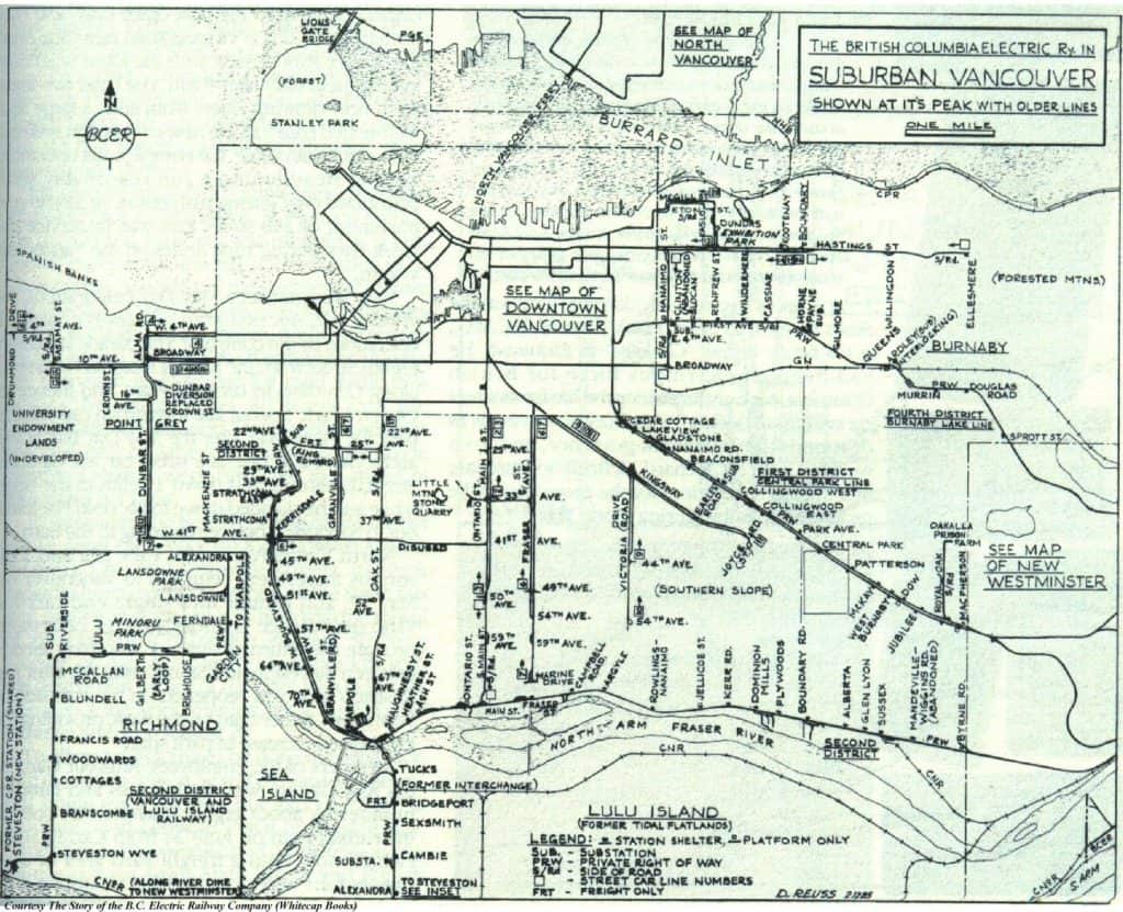
In 1905, the BC Electric Company (BCER) leased the line from the CPR, electrified it, and began running a regular interurban service. The interurban departed from the north end of the Granville Bridge, crossed the Kitsilano Trestle and stopped at Millside (4th Avenue), 9th Avenue (Broadway), Kerrisdale (41st), Magee, and Eburne. Stations were added later at the Quilchena Golf Course at 29th Ave, Shannon (57th Ave) and Townsend (70th Ave). Stations along the Lulu Island branch were named after landowners who donated land to have the BCER install a stop nearby. Return fare from Vancouver to Eburne for 40 cents and to Steveston for 85 cents.
The line spurred settlement on the west side of the city, and led to the establishment of Kerrisdale as a village centre (the trip from Vancouver to Kerrisdale took just 16 minutes and trains ran every half hour). Freight trains also ran on the track. Richmond farmers shipped milk in ten-gallon cans to Vancouver in the morning and had them return in the evening filled with spring water. “Fresh drinking water was a precious commodity to the Islanders” prior to the installation of water mains, writes Ron Hyde, author of a book on the Sockeye Special line. During World War II, the trains carried workers to Marpole, where buses would take them to a Boeing construction factory on Sea Island.
The Rail System’s Demise
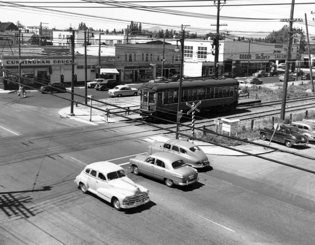
The city’s rail system saw its demise in the 1950s, due to the explosion of car culture, diminishing funds and BC Electric’s “Rails to Rubber” program which converted most of the streetcar lines to trolley bus lines. The Lower Mainland interurban trains ceased operation in 1952, but short freight trains continued to use the tracks until 2001. Before the service came to an end in 2001, the Molson Brewery was Canadian Pacific’s only customer along the Arbutus Corridor rail line.
CPR v City of Vancouver: The Battle for the Arbutus Corridor
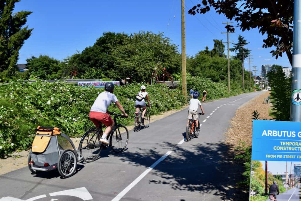
After the last train stopped running, the Arbutus corridor was gradually taken over by community gardens, pedestrians and cyclists. Meanwhile, a legal battle ensued between the City of Vancouver and the CPR that went all the way to the Supreme Court. The city wanted to use the corridor for public transit or as a greenway, while the CPR wanted to develop the land for residential and commercial purposes. In 2006, the Supreme Court agreed that the City had the right to prohibit development for uses other than a railway, but the fate of the corridor was still unclear.
A New Era: From Railway to Greenway… and possibly back to Streetcars
In 2016, the conflict was resolved when the City of Vancouver acquired the Arbutus corridor from Canadian Pacific Railway for $55 million. The City’s plans include transforming the corridor into a greenway for walking, cycling and other non-motorized modes of transportation, and to connect communities from False Creek to the Fraser River. A streetcar route is also part of the long-term vision for the greenway. Check out the current MAP. And information boards about future plans here.
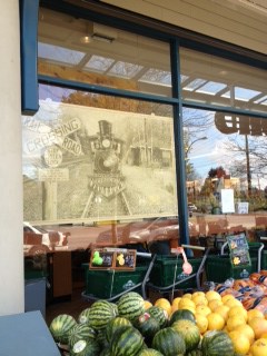
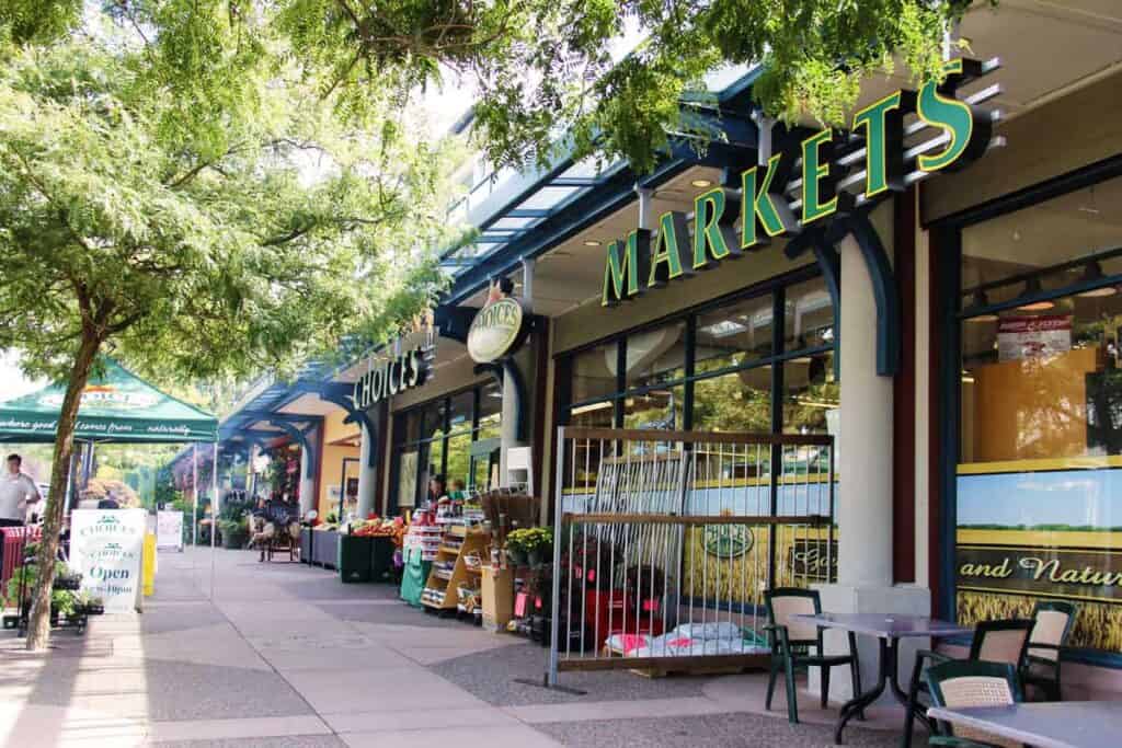
Plaque Location– the former “Shannon” stop of the interurban at W 57th and E. Boulevard/Arbutus. Stop by Choices Market and you’ll find details inside the store referencing its interurban past.
Sources
Nearby Places That Matter
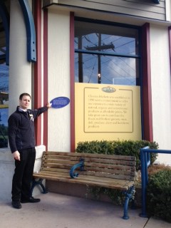
 Plaque is located on the exterior of Choices Market facing W 57th Ave